
Why the South Island Is the Greatest Driver’s Country on Earth
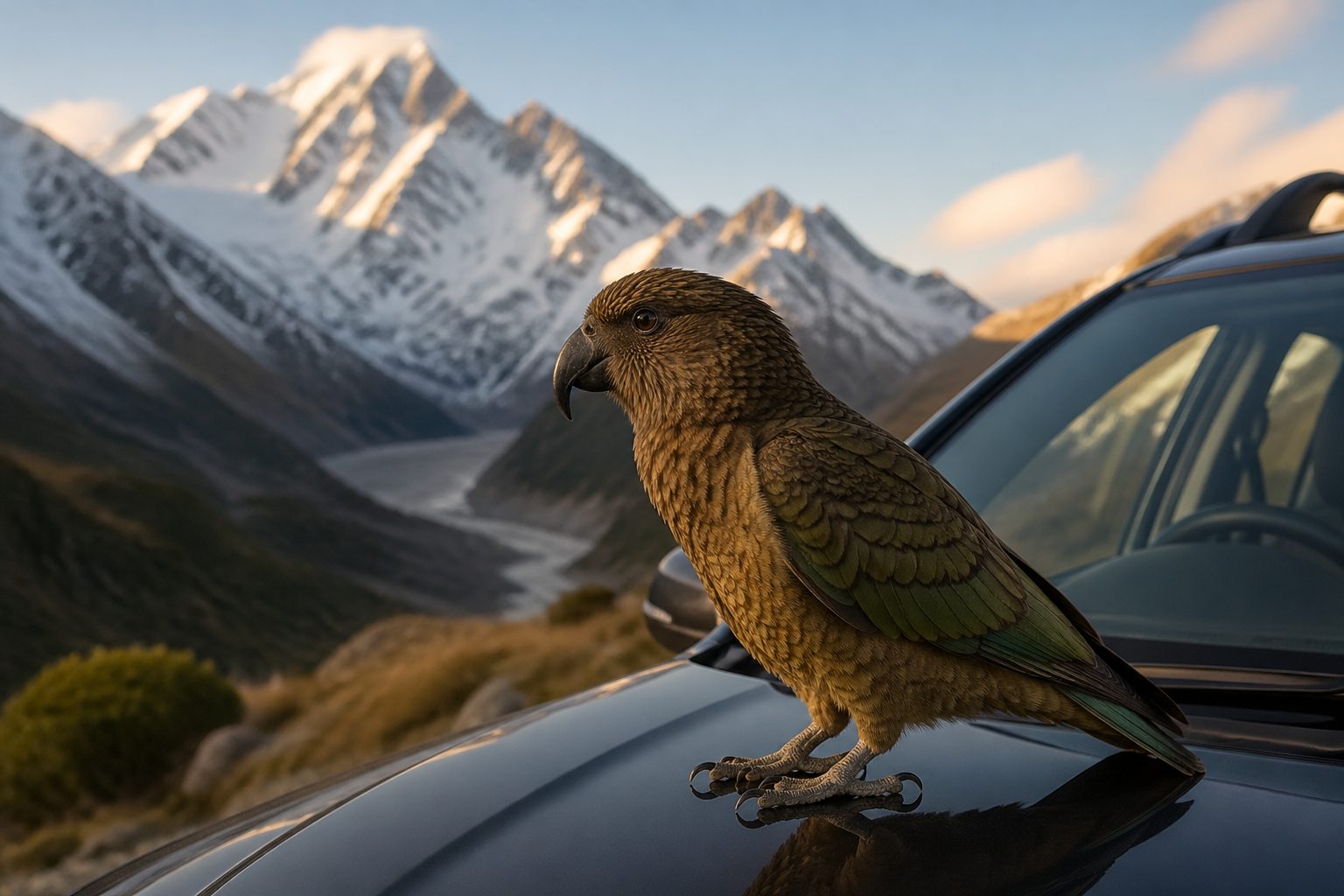
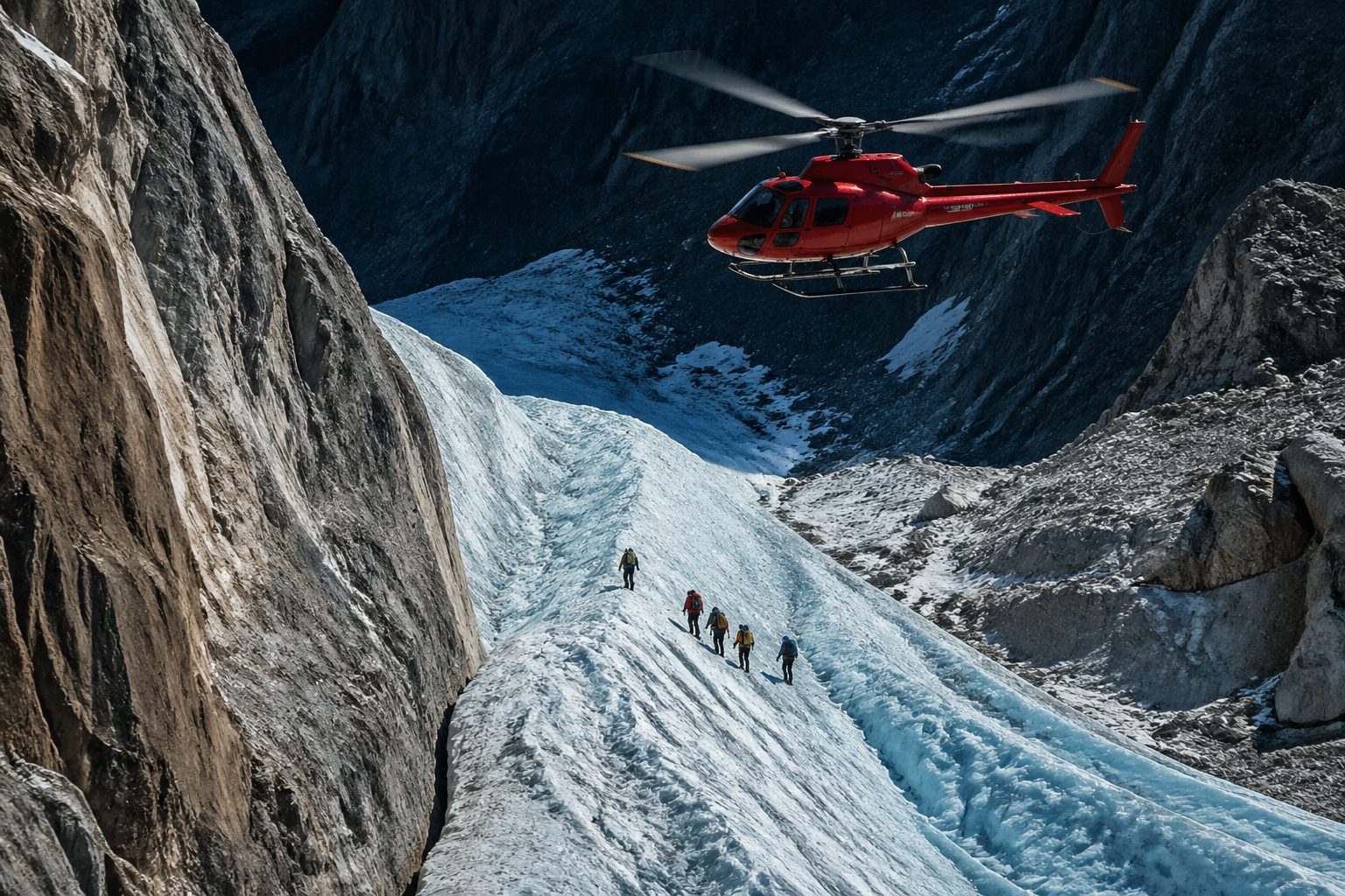
You will smell it before you see it — the dry, peppery sub-alpine tussock at Lindis Pass, sun-baked at the height of late February, the kind of smell that lodges itself in memory the way salt lodges in beach hair. Twenty minutes later you will hear something else: the gravel-on-rubber scrape of a kea, the world’s only alpine parrot, methodically pulling the weather seal off your rental car at Arthur’s Pass. The kea will make eye contact while it does this. It is not sorry.
The South Island runs about 800 km from the cold-current rocks of Cape Foulwind down to the wave-pummelled Catlins headlands, and across that span you cross twelve recognisably different landscapes — beech rainforest, fjord, alpine plateau, braided river, vineyard, glacier valley, salt-flat estuary, cabbage-tree pasture, schist tor, kelp coast, lake basin, golden tussock. The whole island holds 150,000 square kilometres and roughly 1.1 million people. That is fewer humans than Auckland alone. Sheep outnumber humans more than seven to one. Stewart Island and the Catlins coast remain almost entirely empty for stretches of an hour at a time.
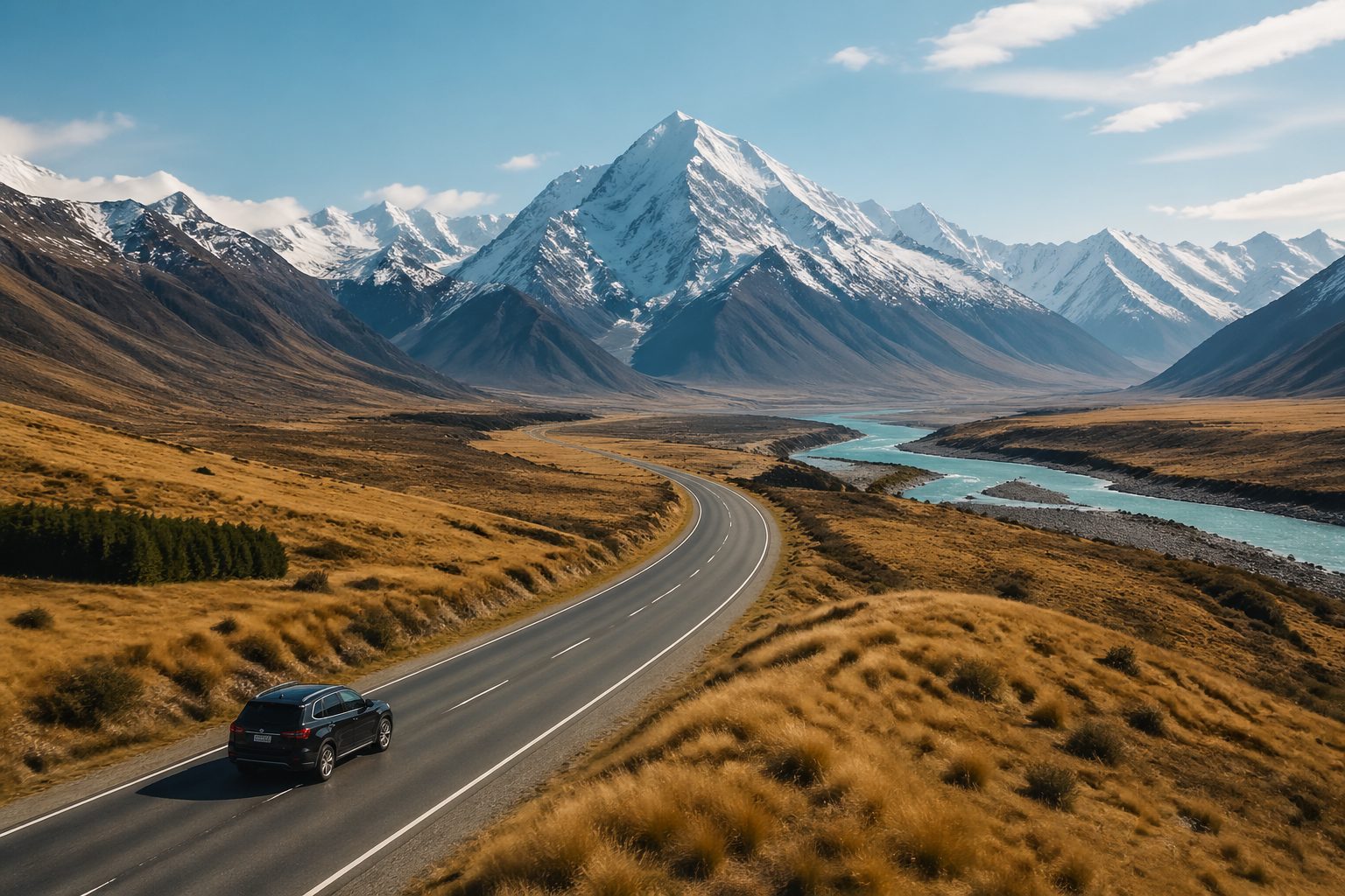
Fiordland was carved by eighteen distinct ice ages. The rivers run cobalt because of suspended rock-flour, ground from the underlying schist by glaciers still receding overhead. You will drive past braided gravel rivers fifty channels wide, then twenty minutes later be the only car on the Crown Range. The road goes where the geology tells it to go, which is usually beautiful and almost always slow.
A few 2026 realities worth knowing before you book. The International Visitor Conservation and Tourism Levy was raised to NZD 100 per person on entry, payable inside the NZeTA application. The Milford Road bus-only-seasons trial was extended for another year, which limits private vehicle access on certain peak days and shoulders. Department of Conservation Great Walks bookings open every October 1 for the following October-to-March season and the Routeburn and Milford slots are gone within minutes. None of this should put you off. It just means you plan with intention rather than rolling up. The reward is one of the last drivable countries on earth where the road is mostly the experience, not the obstacle between experiences.
Renting a Car or Campervan in New Zealand
The first decision shapes the trip more than any other: where you pick up and what you drive. Most international flights land at Christchurch International (CHC) or Queenstown (ZQN). A Christchurch start gives you a north-to-south scenic flow with the dramatic Milford Sound finale; a Queenstown start launches straight into the action and finishes flatter through the Canterbury Plains. Both work. One-way drop-off fees usually run NZD 200 to 400 depending on the operator, so a round-trip is materially cheaper if your flights allow it.
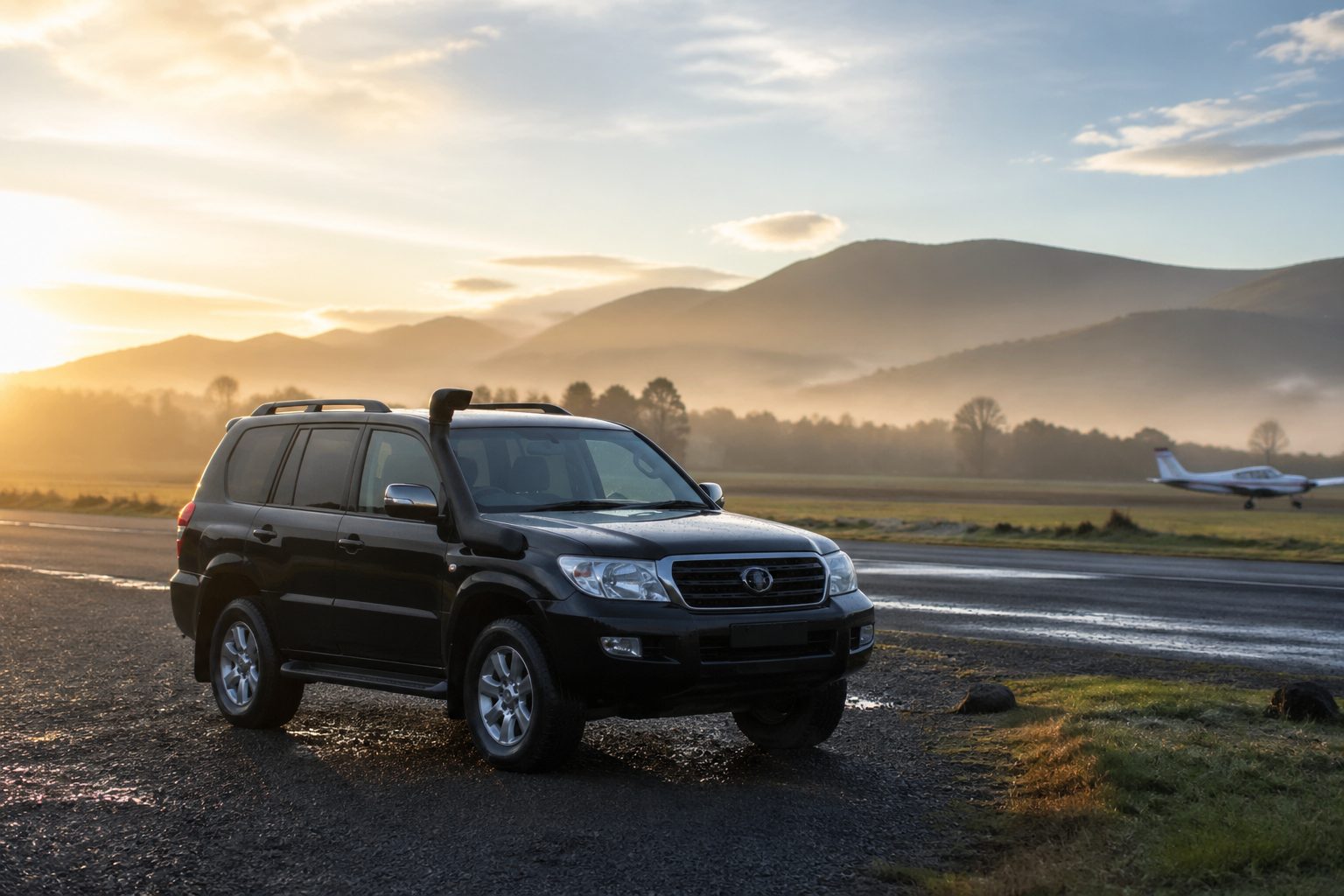
Now the vehicle. A compact economy car runs NZD 50 to 90 per day in 2026, and is fine if you stick exclusively to the sealed state highways. A 4WD SUV — the practical choice for the full South Island loop — runs NZD 90 to 140 per day and is what we recommend for shoulder-season travel when a Crown Range dusting or a Catlins gravel spur is in play. A 2-berth self-contained campervan runs NZD 120 to 220 per day fully equipped, and the self-contained certification matters because that is the sticker that lets you legally freedom-camp at Department of Conservation sites instead of paying for holiday parks. A 6-berth motorhome for a family or a group of four friends sits between NZD 200 and 400 per day.
DiscoverCars aggregates most of the recognised local and international rental brands at both airports — Apex, GO Rentals, Jucy, Britz, Maui — so you can sort by total cost including the one-way fee in a single pass instead of opening eight tabs. The 365-day cookie window is also unusually long, which matters if you are pricing a trip three months out.
A few practical driving notes. New Zealand drives on the left. Rural routes have a lot of one-lane bridges where the give-way is signed by direction; read the sign and stop if your arrow is the small one. Some West Coast and Catlins spurs are gravel and your insurance excess on gravel can be punishing if you are in a 2WD. You do not strictly need snow chains on the standard route in summer, but a set in the boot is sensible for a Crown Range crossing in late autumn. An International Driving Permit is recommended alongside your home licence and is occasionally requested at pickup. Fuel is expensive at NZD 2.85 per litre or so, which matters for any 14-day budget.
Day 1-3: Christchurch, Akaroa & Crossing the Southern Alps
Day 1 lands you at Christchurch International. Pick up the rental, fight the post-flight fog with a flat white, and point the car east toward Banks Peninsula. The drive to Akaroa takes about 90 minutes, climbing over the Hilltop saddle into a series of volcanic-crater harbours, then dropping steeply into the village itself. Akaroa was settled by French colonists in 1840 and the heritage is real — French street names, a small French quarter, croissants that hold up. Black Cat Cruises runs harbour trips out to a resident pod of Hector’s dolphins for around NZD 90, peak November to April. They are the world’s smallest marine dolphin and a single sighting is genuinely memorable. Maison de la Mer or Akaroa Cottages both work for a one-night stay.
Day 2 is a slow return to Christchurch via Sumner Beach for fish and chips on the sand. The city itself rewards an afternoon. The 2011 earthquake destroyed the central business district and the rebuild has been honest and unhurried — the Cardboard Cathedral built by Shigeru Ban as the temporary replacement for the ruined Anglican cathedral, the Re:START container mall ground (now redeveloped but commemorated), the Botanic Gardens and the punt rides on the Avon. Stay near the Re:START quarter. There are good bookable hotels in the rebuild — the Distinction, the Sudima, the George — and Booking.com runs the inventory at recognisable rates with same-day cancellation on flexible bookings, which matters because Day 3 is weather-dependent.
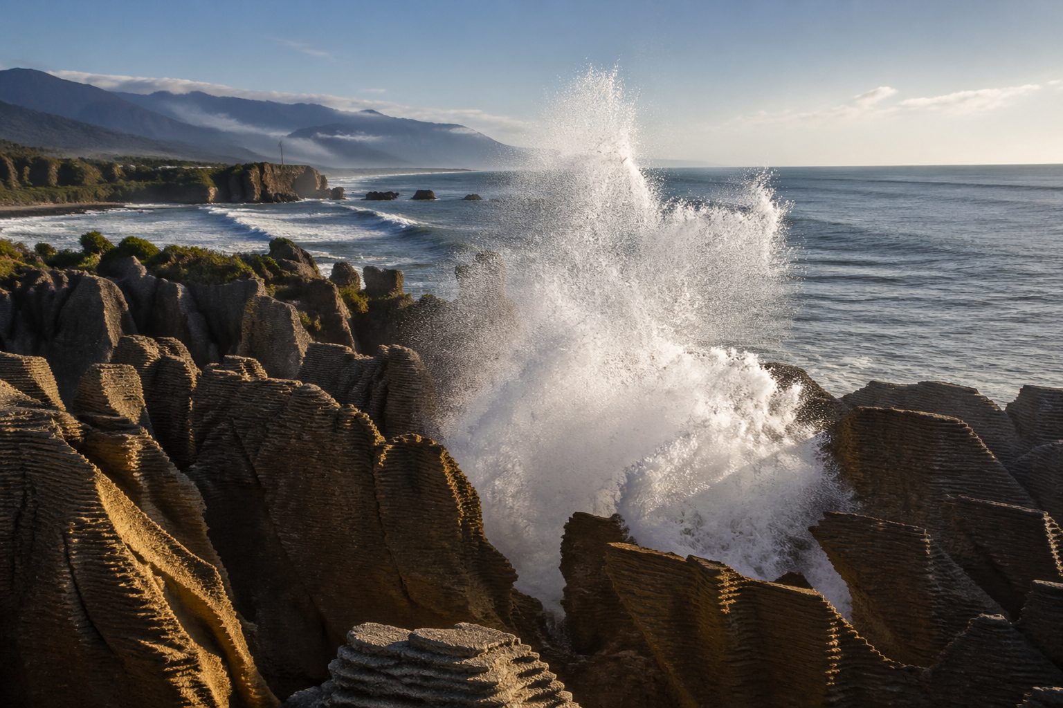
Day 3 is the first real driving day: Christchurch to Greymouth via Arthur’s Pass, about 5 hours on State Highway 73, the most dramatic alpine road in the country. The TranzAlpine train runs the same route if you ever want to do it backwards. You climb out of the Canterbury Plains into beech forest, summit at 920 metres, then drop down the Otira Gorge on a road carved into the western escarpment. Stop at the Arthur’s Pass village for kea (yes, the same parrot — it lives here), and at Otira viaduct for the photo. Once on the West Coast, head 30 minutes north of Greymouth to Punakaiki for the Pancake Rocks loop walk — 20 minutes, free, time it for high tide and a southerly swell so the blowholes work. Stay Greymouth or, better, the Punakaiki Resort right on the beach.
Day 4-5: West Coast Glaciers — Franz Josef & Fox
Day 4 is the south leg of the West Coast: Greymouth to Franz Josef village on State Highway 6, about 3 hours through Hokitika and a string of one-lane bridges over rain-fattened rivers. The forest closes in. You cross into a temperate rainforest where the moss on a single beech trunk can be six inches thick. Franz Josef village itself is small — a single main strip, a couple of pubs, a 24-hour servo, and the helicopter pads.
The heli-hike on Franz Josef is the experience. The Helicopter Line and Glacier Heli Hikes both run combined fly-and-walk packages around NZD 580 per person, weather-dependent, three to four hours total with about two hours of cramponing on the ice. You will not get to the glacier on foot anymore — the valley walk is now a 1.5-hour return stroll to a viewpoint roughly a kilometre short of the terminal face, because the glacier has retreated about a kilometre since 2008. That is not editorialising; that is signposted on the Department of Conservation panels along the trail. The retreat is a real part of the visit. A glow-worm valley walk at dusk inside the rainforest is the free alternative if the heli is fogged in.
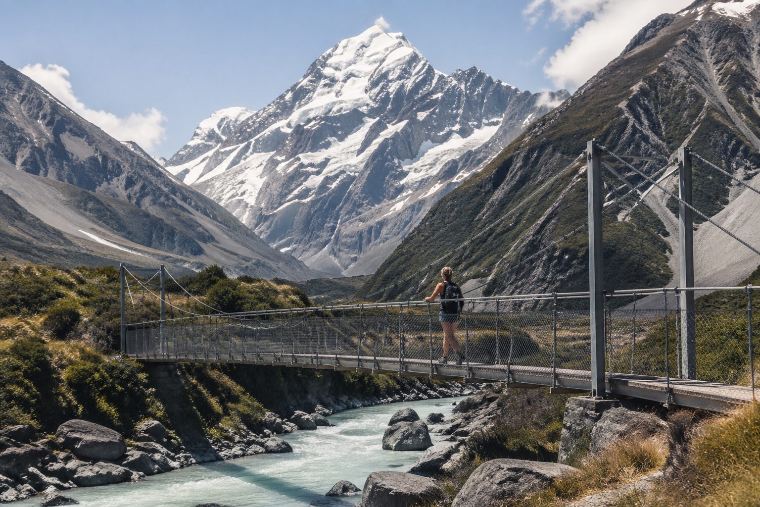
Day 5 — drive 30 minutes south to Fox Glacier village. Lake Matheson is the famous reflection: a 90-minute loop walk through forest to a wooden viewing platform that, on a still morning, mirrors Aoraki/Mt Cook in glassy water. Sunrise gives the cleanest reflection but the weather is fickle and you may get nothing — go anyway, the walk itself is gorgeous. From Fox, continue south to Haast, 2.5 hours through some of the wildest forest road in the country. Fuel up at Haast: it is the last petrol before Wanaka and the Haast Pass climb burns more than you think. The pass crossing — a low 564-metre saddle that punches through into Otago — drops you out of rainforest and into a completely different world of golden tussock and turquoise lakes within 40 minutes. Stay Wanaka. GetYourGuide bundles the heli-hikes alongside Lake Matheson scenic flights if you want to lock both in before you leave home.
Day 6-8: Wanaka, Queenstown & Glenorchy
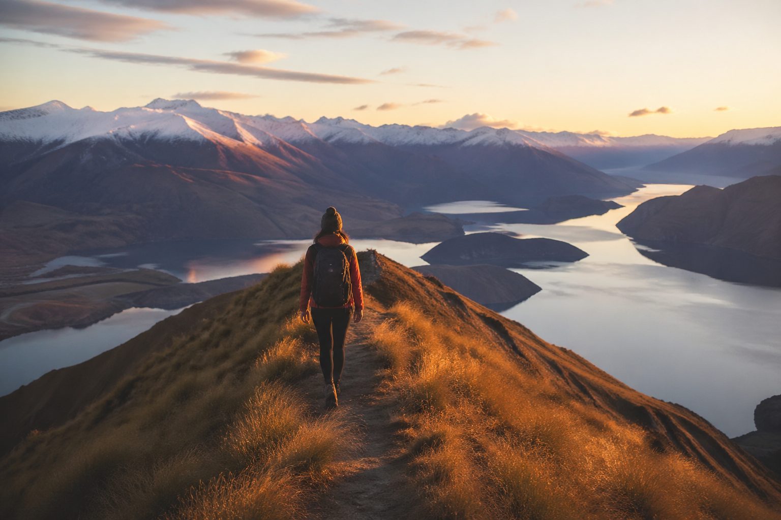
Day 6 belongs to Roy’s Peak. The track is 16 km return, climbing 1,250 vertical metres along an exposed ridge, and most fit hikers do it in 5 to 7 hours. Start before 6 am if you want the ridge photo without a queue, because by 9 am there is genuinely a queue at the famous foreground rock — over a thousand visitors per day in peak season — and the wind on the ridge is real. Bring a windshell even on a forecast bluebird. If your knees say no, the Wanaka Lavender Farm and the lone Wanaka tree at the lake edge are your low-effort alternatives. The Cardrona Hotel, the oldest pub in New Zealand at 1863, sits on the Crown Range road on the way out of town and is a good lunch.
Day 7 is the Crown Range crossing into Queenstown — only 45 minutes but possibly the most scenic short drive in the country. You cross the highest sealed road in New Zealand at 1,121 metres, switchback down through the Cardrona valley, and emerge above Lake Wakatipu. Queenstown itself is unapologetically the adventure capital. Original Kawarau Bridge bungy is here — the world’s first commercial bungy site, opened by AJ Hackett in 1988, NZD 275 for the 43-metre drop. Shotover Jet runs at NZD 165 per person for a thirty-minute spin through the Shotover canyon. The Skyline Gondola plus luge is the milder family option. Stay two nights central — the Sofitel, the Crowne Plaza, and a cluster of well-rated apartments all sit within walking distance of the lakefront on Booking.com.
Day 8 is Glenorchy. The drive is 45 minutes along the Glenorchy-Queenstown Road, an undulating shoreline of Lake Wakatipu that locals will tell you with a straight face is the most beautiful 45 minutes of road on earth. They are not necessarily wrong. Glenorchy itself is a tiny town with a red shed jetty, a couple of cafes, and a horse-trekking outfit. Push another 20 minutes inland into Paradise Valley — yes, that is the actual name on the map — and you are in Lothlorien from Lord of the Rings. On the way back, swing through Gibbston Valley wineries for a late-afternoon Pinot Noir tasting at Mt Difficulty or Peregrine.
Day 9-10: Te Anau & Milford Sound
Day 9 — drive Queenstown to Te Anau, about 2 hours on State Highway 6 then 94 through the Mararoa Valley. Te Anau is the gateway to Fiordland National Park, a small lakefront town built almost entirely around the park traffic. The Te Anau Glow Worm Caves boat tour with Real Journeys runs about 2 hours and costs NZD 100 — small open punt through a lit limestone cave system to a chamber where the ceiling becomes a star map of glow-worm larvae. It is genuinely magical. Stay Te Anau. There are good lakefront motels here that book up; secure a room in advance.
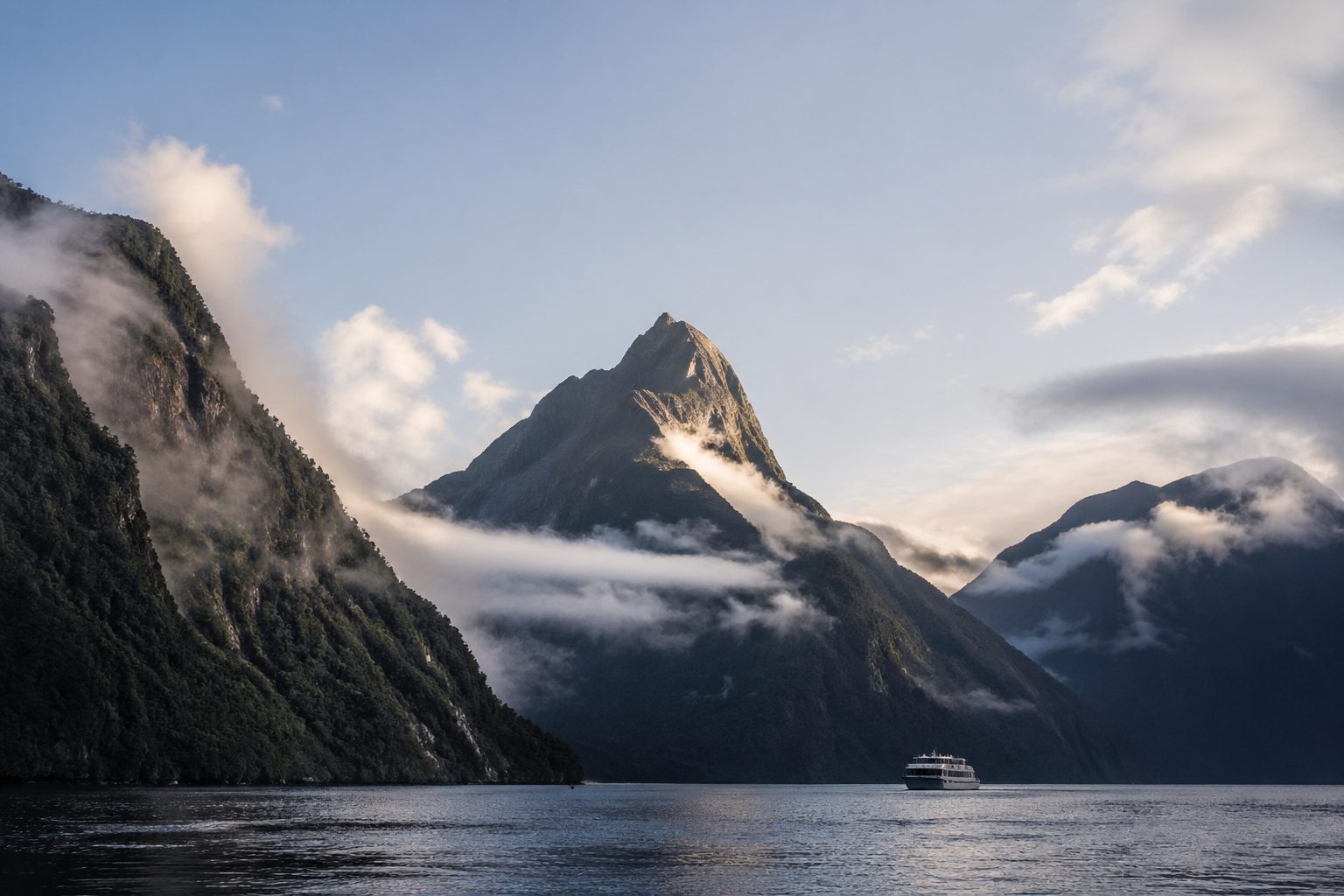
Day 10 is the Milford Sound day, and it has to be done correctly. Set the alarm for 5:00 am. Leave Te Anau by 5:30 am for the 2-hour-15-minute drive on the Milford Road. You go through the Eglinton Valley as it lights up at dawn — a cathedral of beech forest with Mirror Lakes about 45 minutes in — then through the single-lane Homer Tunnel, which is signal-controlled and can hold for 15 minutes either direction. Aim for a 9 am or 10 am cruise. Real Journeys and Mitre Peak Cruises both run 1.5-hour Sound cruises in the NZD 90 to 130 range, with the Encounter Nature cruise on a smaller boat being the better photographer’s choice. Underwater Observatory at Harrison Cove is the worthwhile add-on for non-divers — black coral at 10 metres in fresh-on-saltwater layered fjord water, a phenomenon found virtually nowhere else.
Drive back to Te Anau the same afternoon. Do not — this is the strong advice — try to push through to Queenstown after dark. The Milford Road has unfenced sheep, kea on the tarmac, and absolutely no lighting; it is a road designed for daylight. Stay Te Anau a second night.
If the drive intimidates you, GetYourGuide and Klook both bundle a fly-cruise-fly day from Queenstown — small fixed-wing plane in, cruise, fly out — for around NZD 480 per person. It saves the 9-hour return drive but trades it for weather risk: scenic flights are cancelled often. The drive is more reliable.
Day 11-12: Catlins Coast & Dunedin
Day 11 is the most underrated leg of the trip. Drive Te Anau through Invercargill to the Catlins on the Southern Scenic Route, then on to Dunedin — 5 to 7 hours including stops, depending on how often you pull over, which will be often. The Catlins is the empty-coast bit. There is one main road and a series of gravel spurs out to headlands.
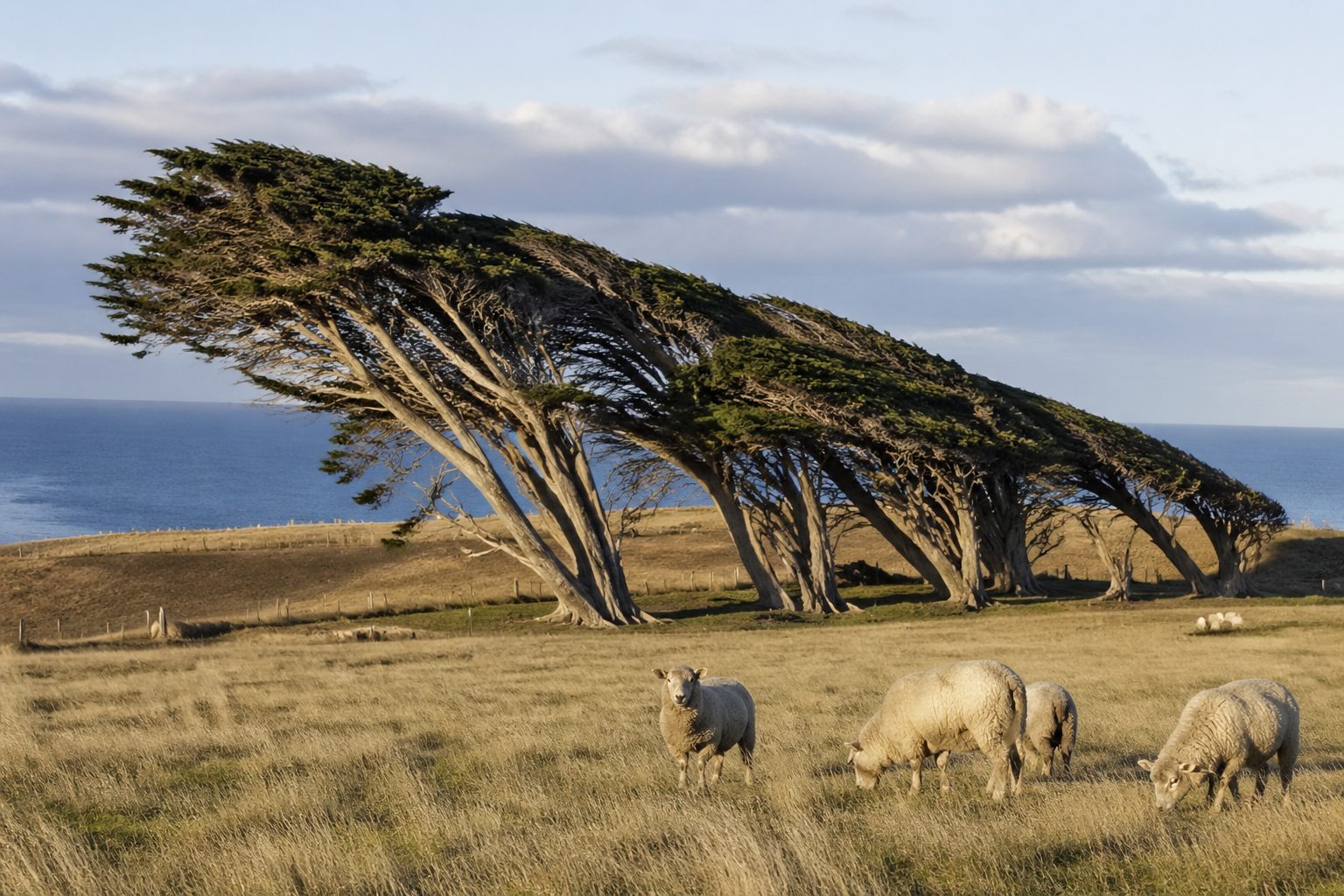
Four stops to plan around. Slope Point is the southernmost point of the South Island mainland — a 20-minute walk across sheep paddocks to a small marker and a row of macrocarpa trees so wind-bent they grow horizontal, the photograph everyone wants. Curio Bay holds a 180-million-year-old petrified Jurassic forest exposed at low tide and a tiny resident pod of Hector’s dolphins that surf the small bay break in the afternoons. Cathedral Caves is two hours either side of low tide only — check the Department of Conservation tide table before you commit, because a rising tide closes the access in minutes — and the cathedral chambers themselves are 30 metres tall. Nugget Point is a perched lighthouse looking out over a string of jagged rock pillars where Hooker’s sea lions, fur seals, and yellow-eyed penguins all share real estate.
Dunedin proper rewards a full Day 12. The Otago Peninsula leaves the city centre as a single road threading along the harbour edge. The Royal Albatross Centre at Taiaroa Head is the only mainland breeding colony of the northern royal albatross on earth, and the guided observatory tour is NZD 60 — you watch wandering-wingspan birds glide in to land on the cliff edge a few metres away. Larnach Castle, halfway out the peninsula, is the only castle in New Zealand and the gardens are excellent. Back in town, Baldwin Street holds the official Guinness record as the steepest residential street in the world at a 35 percent gradient near the top. Walk it, do not drive it. Stay another night in Dunedin or push 90 minutes further on to Oamaru if you want to start Day 13 closer to Aoraki.
Day 13-14: Aoraki/Mt Cook & Return to Christchurch
Day 13 is the big inland drive: Dunedin to Aoraki/Mt Cook National Park via Lake Tekapo, about 4.5 hours on State Highway 8. You cross the Maniototo Plateau, climb past Lindis Pass — that tussock-and-pepper smell again — and drop down to the Mackenzie Basin. Lake Tekapo is the unbelievable turquoise lake everyone has seen on a calendar; the colour is suspended glacier flour and changes by the hour as the wind moves the surface layer. Stop at the Church of the Good Shepherd on the lakeshore. Tekapo Springs hot pools are NZD 35 and worth the soak. The whole Mackenzie Basin is an International Dark Sky Reserve, the largest in the southern hemisphere — if you can stay until full dark, the Milky Way is a physical thing you can read print under.
From Tekapo, an hour west on the Mt Cook Road brings you up the spine of Lake Pukaki — same colour, larger — to Aoraki/Mt Cook Village at the base of New Zealand’s tallest peak. The Hooker Valley Track is the must-do walk: 10 km return, 3 hours, pancake-flat across three swing-bridges to the terminal lake of the Hooker Glacier. Icebergs float in it. In April the lake is calving small blocks every few minutes. The Tasman Glacier viewpoint is a separate short walk and worth the side trip for the scale. Stay The Hermitage Hotel for the in-park experience or Mount Cook Lodge as the value option; both are bookable on the usual platforms.
Day 14 closes the loop. Drive Aoraki to Christchurch via State Highways 8 and 72, about 4 hours through the patchwork pasture of the Canterbury Plains. Return the rental at Christchurch International, hand back the keys with the same odometer reading sequence you have been quietly tallying for two weeks (it will be somewhere around 3,200 to 3,500 km), and fly out. The South Island is one of those rare places where the ending of the trip already starts you planning the next one.
South Island Road Trip Budget: Real 2026 Numbers in NZD + USD
An honest 14-day couples self-drive looks like this in 2026, with both currencies because the headline NZD numbers shock American travellers more than the USD reality.
Vehicle. A 4WD SUV rental plus standard insurance over 14 days runs roughly USD 1,400 to 1,950, or NZD 2,300 to 3,200. DiscoverCars usually beats walk-up airport rates by 10 to 25 percent and locks the price in your home currency at booking, which matters more than people think when the kiwi fluctuates against the dollar.
Accommodation. Thirteen nights of mid-tier hotels and motels — think Distinction, Sudima, the better-rated Booking.com inventory — runs USD 2,400 to 3,400, or NZD 3,950 to 5,600. Wanaka, Queenstown and Aoraki/Mt Cook are the price spikes. A campervan strategy collapses this line item by USD 800 or more.
Drive. Petrol over the full 3,200 km loop runs about USD 380, or NZD 625, at the prevailing 2.85 NZD per litre. Fuel up before the gaps — Haast, Te Anau, Twizel.
Food. Six nights of campervan or Airbnb cooking from Pak’nSave or New World groceries lands around USD 380. Eight restaurant dinners at the level of a decent harbourfront fish dinner in Akaroa or a Queenstown pub plate runs USD 650.
Experiences. The Milford Sound cruise plus the Te Anau Glow-worm Caves plus one helicopter — pick either the Franz Josef heli-hike or a Mt Cook scenic flight — totals about USD 820, or NZD 1,350. Add Queenstown bungy or Shotover Jet at USD 165. Department of Conservation site fees and minor entries run another USD 110.
Mandatory. The International Visitor Conservation and Tourism Levy is NZD 100 per person on entry, paid inside the NZeTA application before you fly.
Grand total ex-international flights, two travellers: USD 6,365 to 8,100, or NZD 10,475 to 13,300. International airfares from US gateways like JFK, SFO or LAX run another USD 2,400 to 3,800 round-trip per person depending on season.
Three real money-savers. Switch the SUV plus hotels combination for a self-contained campervan strategy and save USD 800 plus, mostly on lodging. Cook six nights from Pak’nSave instead of restauranting them. Travel May to October when the South Island is technically off-peak — Crown Range, Milford Road and Aoraki are all still drivable for a competent self-driver, the snowfall photographs better, and rental rates drop 20 to 30 percent. DiscoverCars, Booking.com and GetYourGuide are the three platforms you actually use to keep that budget honest.
Frequently Asked Questions
Fourteen days is the minimum honest itinerary for the loop described here. You can do a faster 10-day version by skipping the Catlins and Dunedin and looping Christchurch-Greymouth-glaciers-Wanaka-Queenstown-Te Anau-Aoraki-Christchurch, but you will be driving more than seeing. Anything under 10 days, fly into Queenstown and stay regional. Three weeks gives you weather buffer days, which the South Island will absolutely use.
Couples or two friends with normal sleeping standards, rent a 4WD SUV and book hotels — the country has excellent affordable motels everywhere, and the comfort beats a campervan over 14 days. Solo travellers, families with kids who like the adventure, or budget-driven couples who want to freedom-camp Department of Conservation sites should rent a self-contained campervan. A 6-berth motorhome works for four adults willing to get on with each other. Confirm the self-contained certification at pickup — without it, you cannot legally freedom-camp.
Late November through April is the safest weather window — drier, longer days, every road open. December and January are peak with peak prices and Roy’s Peak queues. February and March are the sweet spot, slightly quieter, and the autumn colour through Wanaka and Arrowtown in late April is genuinely worth seeing. May through September is winter; the Crown Range, Milford Road and Lindis Pass can all close briefly for snow but the route remains driveable for a competent driver, rates drop 20 to 30 percent, and the alps photograph better with snow on them.
Not strictly. The full loop described here is sealed road from Christchurch to Akaroa to Greymouth to Franz Josef to Wanaka to Queenstown to Te Anau to Milford to Dunedin to Aoraki and back. A 2WD compact will do it in summer. We recommend a 4WD SUV because the gravel spurs in the Catlins, the Mt Cook side roads, and the Crown Range in shoulder season all benefit from the clearance and the traction, and your insurance excess on gravel in a 2WD can be brutal.
Yes — but do it correctly. Stay one night in Te Anau, leave Te Anau at 5:30 am, take a 9 or 10 am cruise, and drive back to Te Anau in daylight. Do not try to day-trip Milford from Queenstown by car; the 9 hours of return driving is brutal and the post-dark Milford Road is genuinely dangerous because of unfenced sheep, kea and no lighting. The Real Journeys or Mitre Peak Cruises 1.5-hour cruise is around NZD 90 to 130. If you cannot face the drive, the fly-cruise-fly day from Queenstown at NZD 480 is the real alternative — but it is weather-cancelled often.
Two travellers, mid-tier hotels, a 4WD SUV, the Milford cruise plus one helicopter, eight restaurant dinners and six self-cooked nights — USD 6,365 to 8,100, which is NZD 10,475 to 13,300, before international flights. Add USD 2,400 to 3,800 per person for round-trip flights from US gateways. Subtract about USD 800 by switching to a self-contained campervan; subtract another USD 200 to 300 by booking shoulder season.
It is a mandatory entry fee of NZD 100 per person, paid inside the NZeTA application before you fly. Children under 2 are exempt. Australian and New Zealand citizens are exempt. The fee was raised to NZD 100 in late 2024 from the original NZD 35 and the funds go to conservation and tourism infrastructure — track maintenance, the Department of Conservation huts, and visitor facilities. Apply for both the NZeTA and the levy together at the official Immigration New Zealand portal at least 72 hours before departure.
