All You Need to Know about Santorini Greece – island of the Cyclades

The name Santorini is a much more recent one. It comes from the Church of the island, which honored St. Irene called “Aghia Irini” by the Greeks and “Santa Rini” by foreign sailors.
This name became established with the linguistic types “Santo-Rini” and Santorini.
Many legends and traditions are connected to the existence of this unique island of the Cyclades. It has been ascertained that its present geographical shape and its geological composition -with the exception of Mt. Profitis Ilias- are the result of the action of the local volcanoes.
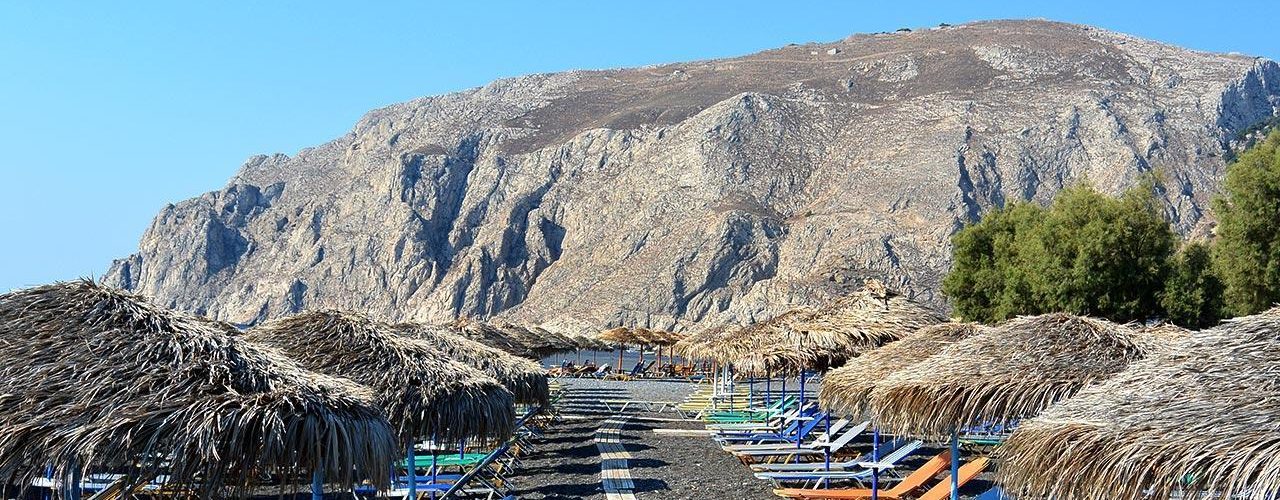
Santorini is different from the other islands of the Cyclades: it is an island built from the thick lava of the volcano, which rose from the molten core of the earth. Its reddish-black bulk, with the unscalable cliffs, the huge masses of rock, and the hard, impressive colours, are all the products of the volcano’s action.
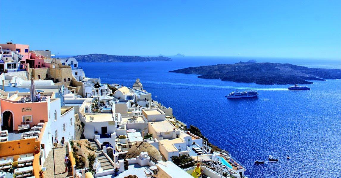
The contrast of the deep blue of the sea with the red, brown, and black colours of the land create a wild, imposing natural beauty not found elsewhere.
Santorini’s landscape, together with the colours of the land and the sea, the rich light, and the depth and clarity of the horizon, create an unforgettable totality, whose charm sweeps away the terror of the nightmarish birth of the island, underlines its dazzling presence, and assures it of winning the first place in the contest of Greek island beauty.
Today, Santorini is no longer the small volcanic island of the Greek archipelago. It is a central island, known all over the world, ready and hospitable to everyone who loves and wants to share its wild natural beauty and be seduced by its light and the clarity of its horizon. Moreover, one can let his imagination travel to the past, to the frightful birth of the island, to feel the insignificance of Man as opposed to the forces of nature, and to follow the ancient inhabitants of the island as they fled the dreadful natural phenomena.
Santorini, however, does not dazzle the visitor solely with the grandeur of a geological phenomenon: it also offers the magic of Atlantis, which legends and the works of Plato identify as this island.

- TRANSPORT-CONNECTION BY SHIP
The distance between Santorini and Piraeus is about 128 nautical miles. The voyage takes between 10 and 15 hours, as the ships also pass by other islands of the Cyclades.
The ship connection between the island and Piraeus is frequent, and in the summer several ships depart daily from Piraeus to Santorini and vice-versa. There are also frequent connections between Santorini and the other Cycladic islands, as well as with Rhodes and Heraklion (Crete).
A local boat connects Santorini with the neighbouring islands.

- TRANSPORT-CONNECTION BY AIR
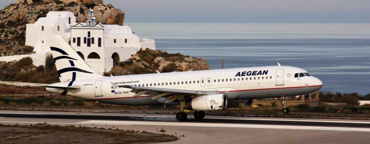
Several daily flights connect the center Athens (ATH) with Santorini Island (JTR). The flight is about 45 minutes and without delays. There is also an air connection with HeraKlion (Crete), Mykonos, and Rhodes.
- SANTORINI AREA POPULATION
Santorini, as it is today, has an area of 76 square kilometers and a population of about 7.000 in-habitants. Its shores are 70 km long. It consists of the main island, THERA, which is shaped like a horseshoe, a smaller one, Therasia, located N.W. of the main island, and an even smaller island, Aspronisi (White Island), which is S.W. of the opening of the horseshoe, towards the Aegean.
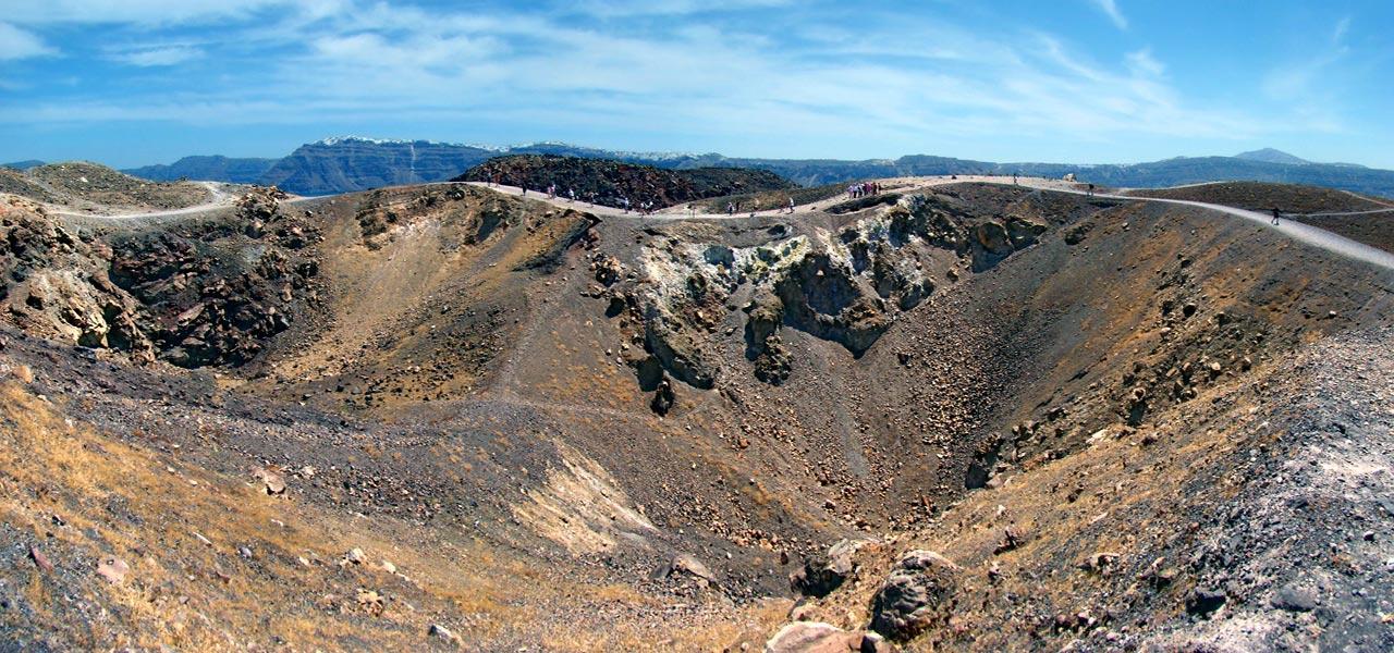
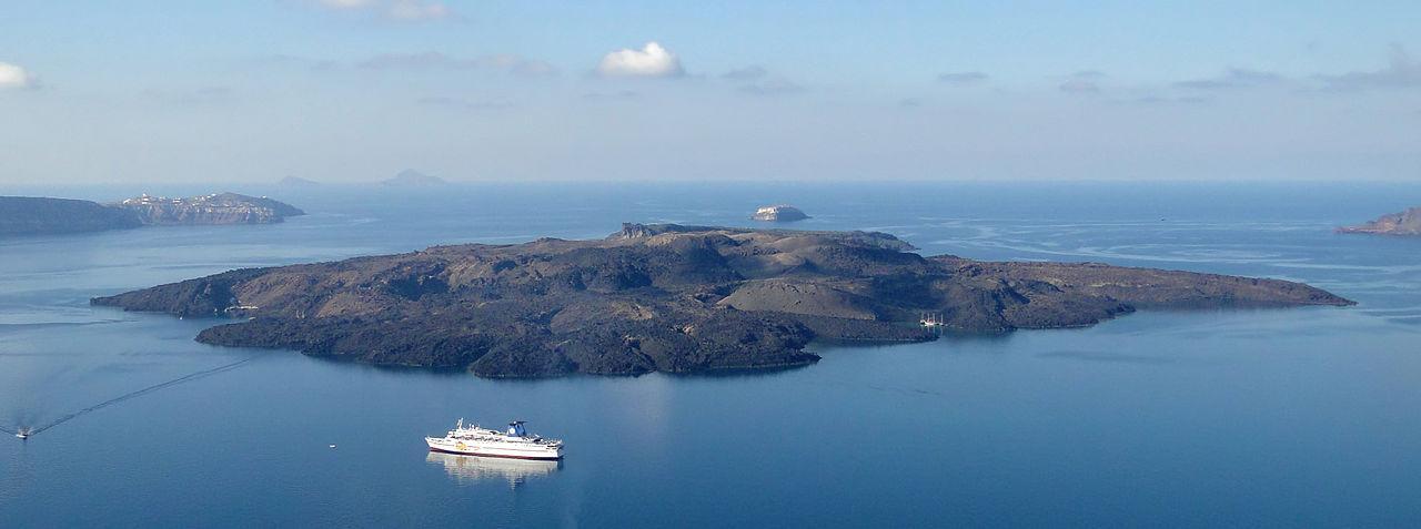
Besides these three islands, there are two more in the aquatic area which is the caldera of the volcano; they rise like volcanic cones from its center and they are PALEA KAMENI (“Old Burnt Island”) and NEA KAMENI (“New Burnt Island”), where the latest crater of the volcano is located.
The length of Santorini, from its most northern end, Cape Mavropetra, till its southernmost end, Cape Exomytis, reaches 18 km. Its width varies from 2 to 6 km.
- MOUNTAINS - CAPE BAYS
MOUNTAINS
The biggest mountain of the island, Mesa Vouno, lies S.W. Its highest peak, Profitis Ilias, is 550 meters high. To the south lies Gavrilos, and to the north Megalo Vouno, 350 meters high, and Mikros Profitis Ilias, 340 meters high.CAPES-BAYS
Starting from the northern end of the island, from Cape Mavropetra, and sailing along the coasts of Santorini, with an E.-N.E. direction at first and then N.E., N., and N.W., we meet the Capes Kolumbo, Bourboulo, Kamari, Aghios Georgios, Mesa Vouno, and Exomytis. Cape Exomytis is at the most southern part of the island. From this point, continuing W., we pass by the Capes Mavro and Akrotiri. By passing this cape, we enter the caldera. Continuing W., we meet the bays Athinio and Kato Fira, and the Capes Skaros and Tourlos. Also the bays Mouzaki and Oia.- WATER SUPPLY - HOT SPRINGS
WATER SUPPLIES
Santorini is almost dry. There are very few springs on the island, and even these do not give much water. In the foothills of Mt. Profitis Ilias there is a spring, although it does not give much water. Another one, called Vryssakia, is east of the mountain, while a third one is in the west part of the island, near Athinio Bay, in the region called Aghios Ioannis. For their daily needs, the in-habitants use rainwater, which is collected in special cisterns during the winter. Every house has its own cistern. Today, the island is also supplied with water by water-carrying ships.HOT SPRINGS
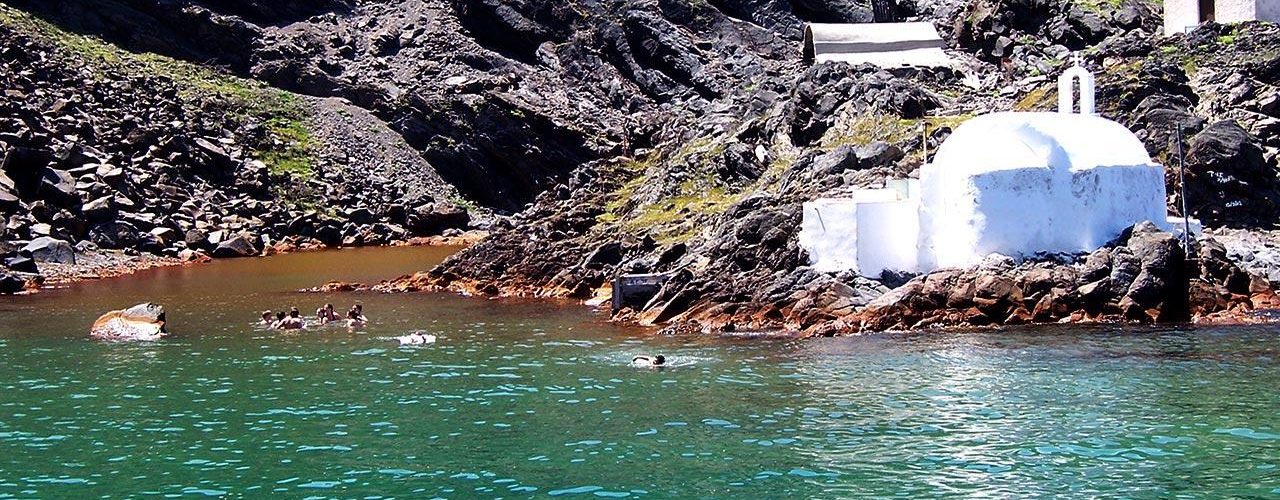
There are four hot, metallic springs on the island. In the Megalochori district the hot spring is known with three names: Atherma, Thermi, and Christ’s spring. A second hot spring, Plaka, is in the same district. Kokkina Nera is in the district of the same name, and, finally, Anavryta spring is in the Emporio village area, in the S. end of the island, near Vlychada.CLIMATE
Santorini has a typical Aegean island climate. It has a cool summer and a mild winter. It rains often during the winter, but rarely -or not at all- during the summer. Snow may fall ocasionally, but it melts almost immediately.
PRODUCTS
Santorini’s fertile volcanic soil, cultivated by its industrious inhabitants, has made the island well known all over Greece for its excellent produce.
Its wines are celebrated. After all, most of the vegetation of the island is grapevines. Also famous is its “fava”, a legume smaller than a pea, which looks like a lentil. Its tomatoes are very tasty, too. They are small, the size of a walnut, because of the lack of water. From these tiny tomatoes the famous tomato paste of Santorini is made, which the local people call “bertes”. Little produce is grown. Some barley, which is used as animal feed, and even less wheat. A kind of cheese, “chloro”, is made from goat milk. It is a tasty cheese. The home-made sausages are very tasty, too. A few animals are bred on the island: some goats, sheep, pigs, and poultry. The production of meat is not sufficient for the present needs of the island.
Finally, Santorini exports the famous “Thera Earth” (pumice stone), the sole mineral of the island. Being an island, seafood is not absent, although it is not exported but consumed locally by Santorini’s inhabitants and visitors.
ARCHAEOLOGY
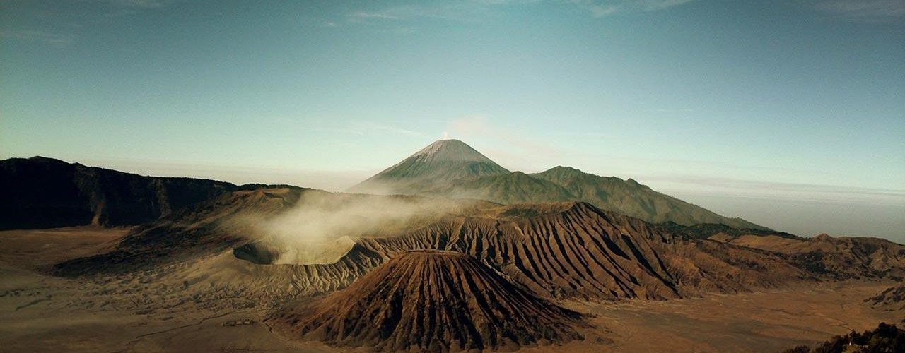
The eastern basin of the Mediterranean took its present aspect during the Pleistocene period.
The area’s great geological upheavals had as a result the disappearance of the great mass of land which existed in the place of the contemporary Aegean archipelago. The great number of islands in the eastern Aegean is all that remains from that land which disappeared under the waters of the sea.
In that period, before the volcano begun its action, there was a small rocky island in the place of today’s Santorini. A remainder of that non-volcanic island is Mt. Profitis Ilias and its foothills. Deep geological fissures rent asunder the land of the small rocky island and the sea bottom near it. The red-hot material of the volcanic source found a passage through the fissures of the sea-bottom. The red-hot lava of the volcano formed the first craters. The huge masses of lava which rose to the surface covered a large part of the original island and extended the land, forming a new island, taller and larger than the original island.
The height of the new island is estimated to have been 600 to a 1000 meters. The new isle, formed by volcanic matter, had the shape of a truncated cone. The base of the cone was shaped roughly like a circle, and the round shape of the new volcanic island was responsible for its new name, “Strongyli” (Round). With the passing of the centuries, flora and fauna appeared on the dry lava. We cannot claim with any certainty whether the flora and fauna attracted the first men there or was it man who brought the plants and animals to the island.
What is certain, however, is that the island has been inhabited since the neolithic age, as the archaeological discoveries indicate. These discoveries, though, are not sufficient to give paleontologists the elements they need to describe the way of life of these early inhabitants of the area. Later discoveries do give a more complete picture of the society of Thera’s prehistoric inhabitants.
PREHISTORIC
The prehistoric inhabitants of the island had developed notable agriculture. They cultivated grapevines, cereals, and fruit trees. Their society was rich and they lived in comfort, as the archaeological discoveries make plain. They did not confine themselves to agriculture, animal breeding, and fishing, but also developed a notable art culture.
The prehistoric inhabitant of Thera has been shown to be a creator of high inspiration and efficiency. Describing the life of the inhabitants of the island, as it was being uncovered, the Greek historian K. Paparrigopoulos writes: “These people were wise builders and expert potters, building their houses with hewn stone to prevent the destructive results of the earthquakes. They placed wooden joints between the walls, used the potter’s wheel, and made vases with original shapes and beautiful decorations. They wove, fished with nets, and most of their tools were made from hewn stone or obsidian. Finally, they knew gold, silver, copper, tin, and bronze – and how to use them”. Even the art of shipbuilding wasn’t unknown to the Therans. They had commercial ties not only with the neighbouring islands but with most powers of the eastern Mediterranean.
Agriculture, animal breeding, fishing, shipping, and commerce were the source of riches of the prehistoric people of Thera. This wondrous civilization, which flowered on a piece of earth born from the destructive fury of ENceladus -and which lived under its constant threat- was stopped and destroyed by the terrible eruption of the volcano in the middle of the 2nd millenium B.C.
It is almost certain that a strong earthquake must have preceded the eruption of the volcano. The destruction caused by this most terrible of all known volcanic eruptions in the world took tremendous proportions. The central part of the island blew up and sunk, forming a huge concavity, in both surface area and depth, which was filled by the sea. The scientific name for this concavity is “caldera”. Santorini’s caldera, together with Lake Oregon, are the largest in the world. The present geographical shape of the island is the direct result of that dreadful explosion.
When the elements of nature quieted and calm was restored, the islands Thera, Therasia, and Aspronisi were all that had been left above the waters, enclosing the caldera like a wreath. At the same time in which the volcano’s explosion changed the face of Thera, another catastrophe was occuring in Crete. The wondrous Minoan civilization was being totally destroyed. The archaeologists spoke about some military invasion. No one had made the connection between the destruction of Thera and the destruction of Crete. The con-nection between the biblical catastrophe of Thera and the destruction of Minoan civilization in Crete was first made by the archaeologist Professor Spyros Marinatos. The theory of the wise professor was greeted with scepticism, reservation, and bellicosity.
Archaeological research, though, soon proved that the pioneering researcher was correct. Today we have solid proof which justifies Spyros Marinatos. Before Professor Marinatos had formulated his theory about the simultaneous ruin of Thera and Crete, he had studied other similar volcanic eruptions. The professor, in order to be able to prove as well as ascertain the extent of the catastrophic eruption of Thera’s volcano on 1500 B.C., compared it to the eruption of Krakatoa on 1877 A.D. in the Suva Straits, which lie near Java and Sumatra in the Indian Ocean.
The archaeologists pick has kept bringing to the surface, from under great masses of lava and pumice, towns, cemeteries, inscriptions, pottery, and statuettes since the end of the 19th century.
The fury of the volcano left the previously rich island silent and desolated. Thousands of tons of lava and ash covered its rich towns and villages. Centuries passed. The reddish-black soil of the island lay undisturbed by farmers’ hands. No shepherds let their sheep graze in its small valleys, and no primitive boats of some brave seamen approached its rocky shores. The desolation and silence would be broken at some point. Somebody brave enough would dare to approach the steep shores, to climb the precipitous cliffs, and to become master of the island.
According to Greek mythology, Theras and his companions were the first inhabitants of the island after the catastrophe. The tough Dorian got over the awe caused by the sight of the island and landed on its shores.
We do not know whether Theras was a real person, but it is a fact that, in the beginning of the 1st millenium B.C., Thera was settled by Dorian Greeks.
The obstinate Dorians did not take long to master the inhospitable land of the island. A new civilization flowered in the kingdom of silence and desolation. This civilization lacked the subtlety and sensitivity of the Ionian one. Dorian civilization was austere and onerous, thus reflecting its creators. However, the Dorian artists were not influenced by the Ionians on the neighbouring islands. Elements of the subtlety and sensitivity of the Ionian artists also appear in the creations of the Theran artisans.
The capital of the island during the Historic years, was the city of Thera. It was so named in honor of King Theras. The city of Thera was discovered by the German archaeologist Hiller von Gaertringen. It was built in the S.W. part of the island, in a rocky area of Mt. Mesa Vouno. On the pass Sellada, which connects Mt. Mesa Vouno with the peak Profitis Ilias, the cemetery of ancient Thera was discovered.
The excavations are bringing continuously to the surface tombs of the 7th century B.C. as well as significant pottery and ceramics of a more recent age. Ancient ruins and tombs have been discovered in many other parts of the island, such as Gonia, which lies between Finikia and Cape Kolumbo, also in Cape Skaros and Cape Exomytis.
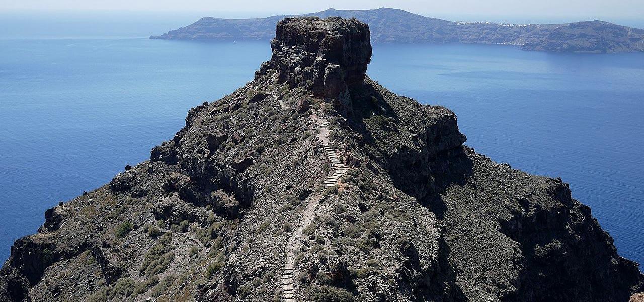
Even Christian art is represented in Santorini with Early Christian, Byzantine and more recent buildings. An example of Byzantine and Venetian castle-building prowess is Castle Skaros.
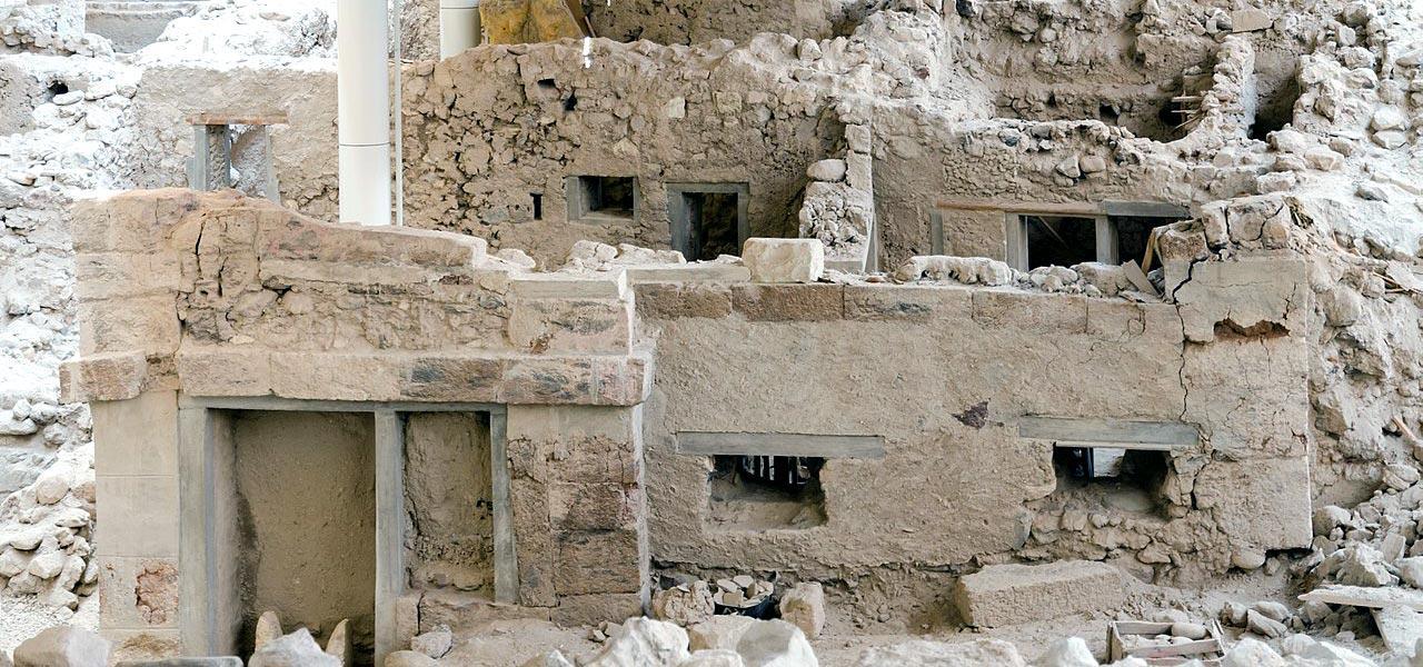
On the island of Santorini, archaeological research, taking place with consistency and continuity, keeps bringing to light the wondrous art that developed on the island since the prehistoric years.
Religion
The Therans, during the idololatric period, worshipped the twelve gods of ancient Greece. They especially honored the god Apollo, who was considered the particular god of the Doric tribe. The mastery of the Ptolemies of Egypt during the Hellenistic years brought the worship of Egyptian deities to the island. The worship of the dead was also widely practiced on Thera.
The island was christianized at about 300 A.D. Both main Christian docrines, the Eastern Orthodox Church and the Catholic Church coexist in Santorini today.
History
The history of the appearance of man on the island, according to archaeological discoveries, starts from the Neolithic age.
During the 3rd millenium B.C., the island was inhabited by the Karians, a people originating on the coast of Asia Minor. The creation of the naval state of Minoan Crete affected the fortunes of Thera’s inhabitants. It did not take long for the Minoan masters of the sea to assert their power on the Therans, both politically and culturally. During the time of the Minoan influence, a remarkable civilization developed.
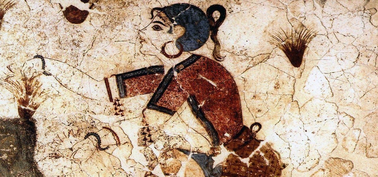
This civilization, in all its glory, was brought to light at Ak- rotiri by the archaeologist’s pick of Professor Marinatos. The cultural and economic flowering of the island was violenly interrupted by the eruption of the volcano, which took place at about 1500 B.C.
For 5 centuries, the island remained deserted. Possibly around 1200 B.C. the Phoenicians, a sea people of the eastern Mediterranean, appeared there.
In the beginning of the 1st millenium B.C., near the year 1000 B.C., the island was colonized by Dorian Greeks. It is possible that they came from Sparta and had Theras son of Autesion as their leader. Thera remained one of the many independent states of ancient Greece until the end of the Persian wars, on 478 B.C. According to Herodotus, the kingdom of Thera was made up by seven municipalities. The Therans, being Dorian, kept good relations with the Dorian cities of the greater Greek region, and kept the manners and customs of their tribe. It was impossible, though, for them not to be somehow influenced by the Ionians, the other great Greek tribe. The people of Thera, following the example of most Greek cities, on 630 B.C., when Grinnos was king of the island, established a colony on the shores of North Africa, called Cyrene. The leader of the colonists was named Vattos.
With the end of the Persian wars, the naval state of Athens emerged as the strongest in the greater Greek region. The mastery of the Athenian democracy over the Greek islands was complete. The dominant position among the states of Greece which Athens gained by virtue of her strong navy, was called the “alliance” by the Athenians. This alliance is known historically as the First Athenian Alliance, centered originally on Delos, the holy island of the Cyclades. At first, the city-states were enlisted in the al-liance as equal “allies”. Later, the seat of the alliance was moved to Athens. The move of the seat of the alliance to Athens was the beginning of the repeal of equality among the allies. Steadily the weaker members of the alliance lost their meagre independence and became politically dependent on Athens. Thera’s passing into Athenian dependency occured on 430 B.C.
The Athenians remained lords of Thera until the end of their war with the Spartans. The military defeat of Athens on 404 B.C. (The civil war of the Greeks, known as the Peloponnesian War, lasted from 427 B.C. till 404 B.C.) meant independence for the island.
Athens required a quarter of a century to overcome the conse-quences of her military defeat. The Athenian triremes reappeared off the island on 378 B.C. to bring it again under the dominion of the reorganized Athenian Alliance. This is the period of the Second Athenian Alliance, which was much inferior in brilliance and power to the First Alliance. The second period of Thera’s dependence from Athens ended with the appearance of the Macedonian Greeks in Southern Greece.
The dismemberment of Alexander the Great’s empire left Thera as a part of the kingdom of the Ptolemies of Egypt. The Ptolemies remained on the island from 275 B.C. till 146 B.C. The kings of Egypt took military advantage of the island’s geographical position. On the south coast of the island the Ptolemies founded Elefsina, a large naval base which safeguarded the northern frontiers of their state.
The military presence of the Ptolemies on the island was ended by the Roman occupation of Greece on 146 B.C. Thera was occupied by the Romans and enrolled to the Roman prefecture of Asia. Thera, being only an insignificant island in the boundless Roman Empire, is not mentioned in Roman historical texts. The Byzantine historians, too, mention Thera only a few times. Purely for information, the Byzantine chronicler Hierocles, and Porphyrogennetos later, wrote that Thera belonged administratively to the Aegean Theme, which had Samos as its capital (Themes were the political and geographical divisions of the Byzantine Empire; they were governed by generals -or admirals for island themes, on whom both political and military power was concentrated).
The last Crusade ended with the conquest of Constantinople by the crusaders. The lands of the empire were divided among the noble crusader leaders. The Aegean, with its islands, was given to Venice as a reward for the naval support given to the crusaders. The Venetian democracy charged the noble Marco Sanudo with the responsibility of conquering the Aegean. The Venetian admiral appeared in the Aegean on 1207 A.D. His aim was the imposition of the sovereignty of the democracy of St. Mark on the inhabitants of the islands of the Aegean.
Thera was occupied by Sanudo and immediately ceded to his colleague Jacobo Varocci. The Varocci family settled on the island until 1269 A.D. For a little while Thera was reclaimed by the Byzantines, but the Varocci won it back after a military clash between the Venetians and Andronicos B’ Palaeologos. The island was also coveted, however, by Nicholas A’ Sanudo, Duke of Naxos.
Sanudo managed to drive away the Varocci on 1335 A.D. and add Thera to the Dukedom of Naxos. The addition of the island to the Dukedom of Naxos cost the Duke a significant amount of money. The island’s adventures do not end, though, with its addition to the Dukedom of Naxos.
The Venetian masters of the area, behaving like genuine over-lords, sold it, gave it away, or ceded it as dowry. Thus, Duke John Crispi, in the beginning of the 15th century, granted Thera to his brother Marco Crispi, lord of neighboring Ios. It was given as dowry on 1480 A.D. to the lords Pisani. Thera remained a feud of the Pisani until 1537 A.D., when the Turkish admiral Chairedin Barbarossa established the rule of the Turkish Sultan.
The years of the Venetian presence on the island were characterized by vigorous piratical action, which impoverished the inhabitants of the island. Besides the ravages of the pirates, the population had to face the bad administration and the greed of the nobles. The administration of the Dukes was characterized by the poverty and unhappiness of their people.
The era of the Pisani was an exception, as an effort to develop the island economically took place at that time. The Pisani period was an economic oasis in a desert of poverty and misfortune. The occupation of Thera by Barbarossa did not bring the Turkish administration on the island immediately. The Turkish Sultan granted Thera to a friend of his, the Spanish adventurer Joseph Nasi. The Ottoman administration was established officially on the island on 1579 A.D.
Vine cultivation: the strange rolling in the shape of a basket is for the protection of the vineyard by strong winds. The Greek Revolution of 1821 A.D. was proclaimed on Thera by Evangelos Mazarakis, an authorized deputy of the revolutionaries on mainland Greece. Thera joined the newly founded Greek state under the Protocol of London (1830).
